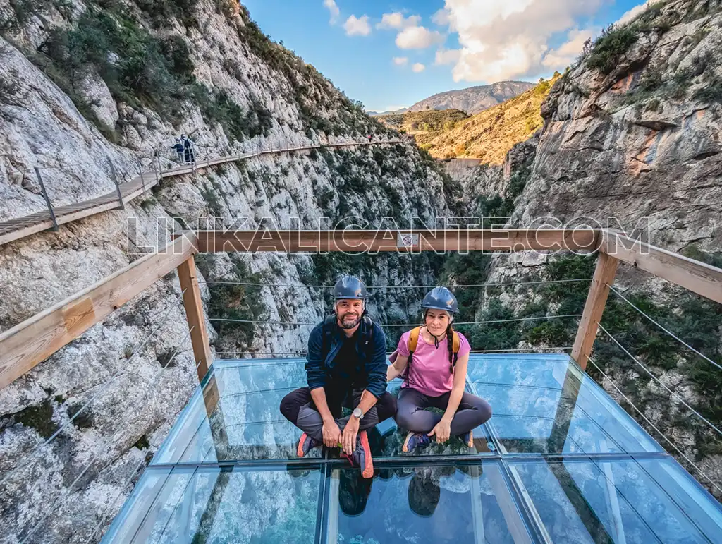
The footbridge of the Relleu dam is a path on wooden planks that runs suspended more than 50 meters above the deep ravine of the Amadorio river.
This is the first and only facility of its kind in the province of Alicante. A tourist attraction that has put Relleu on the map and allows people of all ages to enter an amazing natural landscape, which was previously reserved only for canyoners.
In this article we tell you what the walkway is like , the hiking route to get there and how to make a reservation to enjoy this exciting activity. Stay to the end and take note!
Índice del Artículo
ToggleBrief description of the walkway route
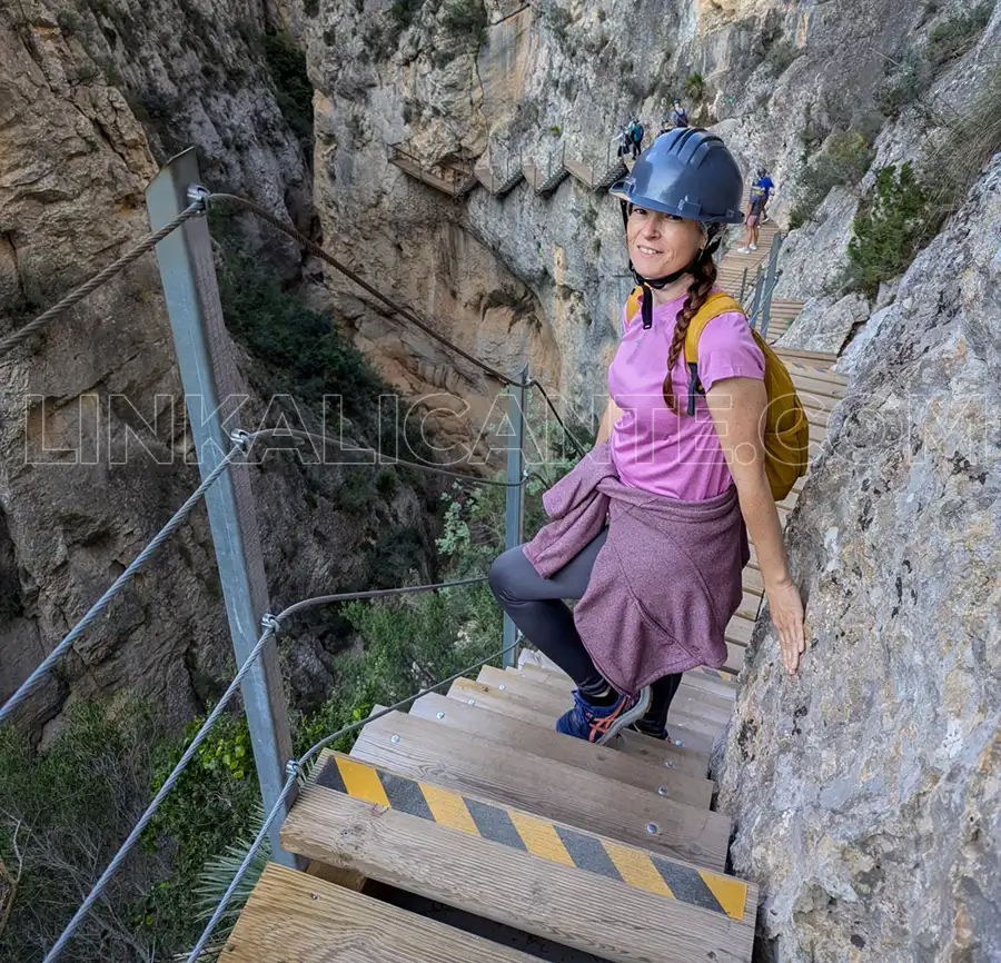
The “floating” footbridge of the Relleu dam has a total length of 390 meters, after the second extension undertaken in December 2024.
This is the route, in parts:
1. First descent by wooden stairs, with 16 steps, followed by a winding horizontal section, with little sensation of emptiness (low height).
2. Longer horizontal section and with quite a feeling of emptiness, since it runs at a great height, about 60 meters.
3. First viewing platform with glass floor. Panoramic view of the entire walkway.
4. Short stretch of horizontal connection with the beginning of the descent.
5. Descent to the bottom of the ravine, consisting of 6 flights of stairs of about 10-15 steps each. It usually gives more of a feeling of emptiness on the way back up.
6. Second observation deck with glass floor (extension December 2024).
The return is by the same route, awaiting the extensions that will complete a circular route, planned for 2025.
Quick Guide
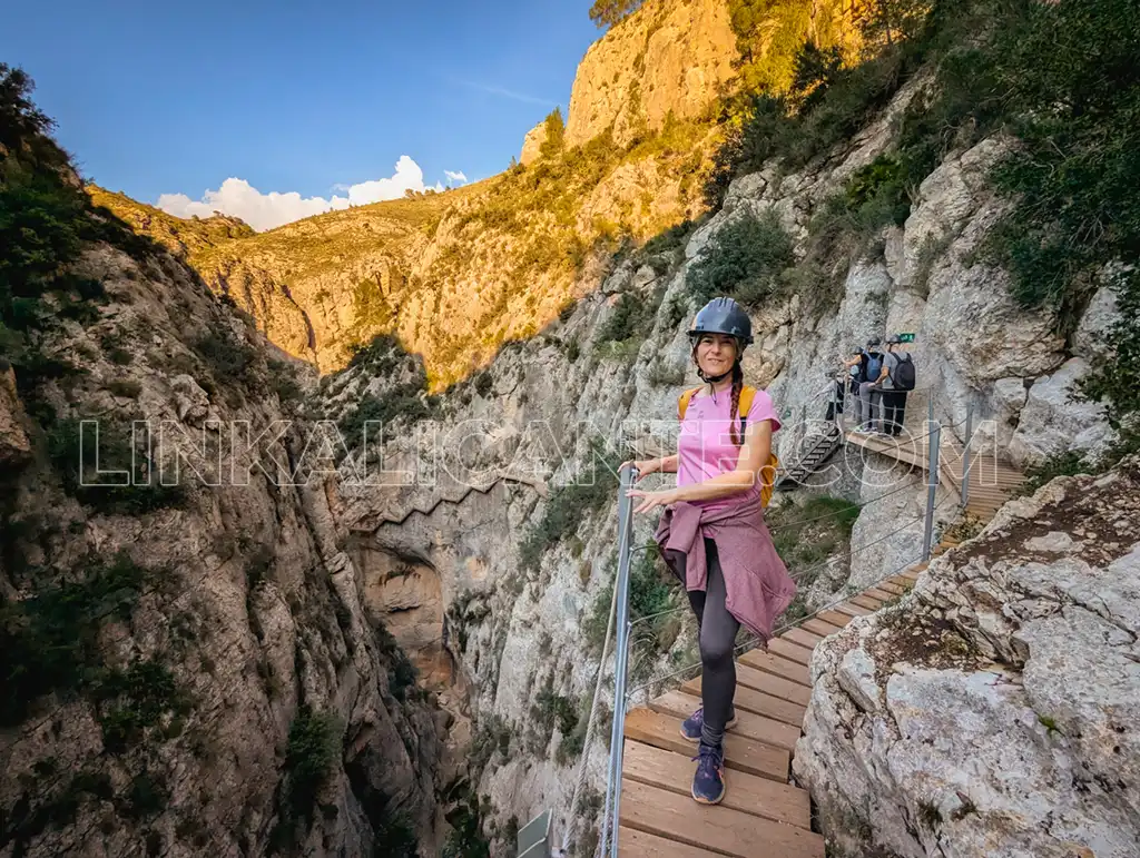
✔️ The floating wooden walkway has a total length of 390 meters, being a round trip (the circular route is scheduled to be completed in 2025).
✔️ You have 2 options to get to the beginning of the footbridge: a short route of 1.5 kilometers one way, or the complete route that starts in the village, about 10 kilometers in total.
✔️ I recommend buying tickets in advance, especially if you go on weekends. When you book your visit, take into account the time it will take you to the start of the walkway, depending on the route you will be taking.
✔️ Read on for all the details.
Visit Information
✓ Timetable Pasarela Relleu: Monday – Sunday, from 9:00 to 18:00 h.
(last pass 17:30 h.).
It may change depending on the time of year and weather.
✓ We recommend purchasing tickets online to expedite access.
Reservation by phone at +34 613 033 336 and 865 759 650 (from 9.00-14.00 h).
✓ Click here to buy tickets online (official website). >>
✓ Catwalk Ticket Price
- 3,50 € for children, adults and seniors.
- Free entry to neighbors registered in Relleu who prove it.
✓ Presence of personnel guarding the facilities.
✓ Helmets are mandatory to access the walkway (provided by the organization).
✓ The capacity of the catwalk is 100 people.
✓ Please note: the reservation is for the gateway entry time.
✓ Download the Route Brochure (PDF) below:
Description of the hiking route to the footbridge
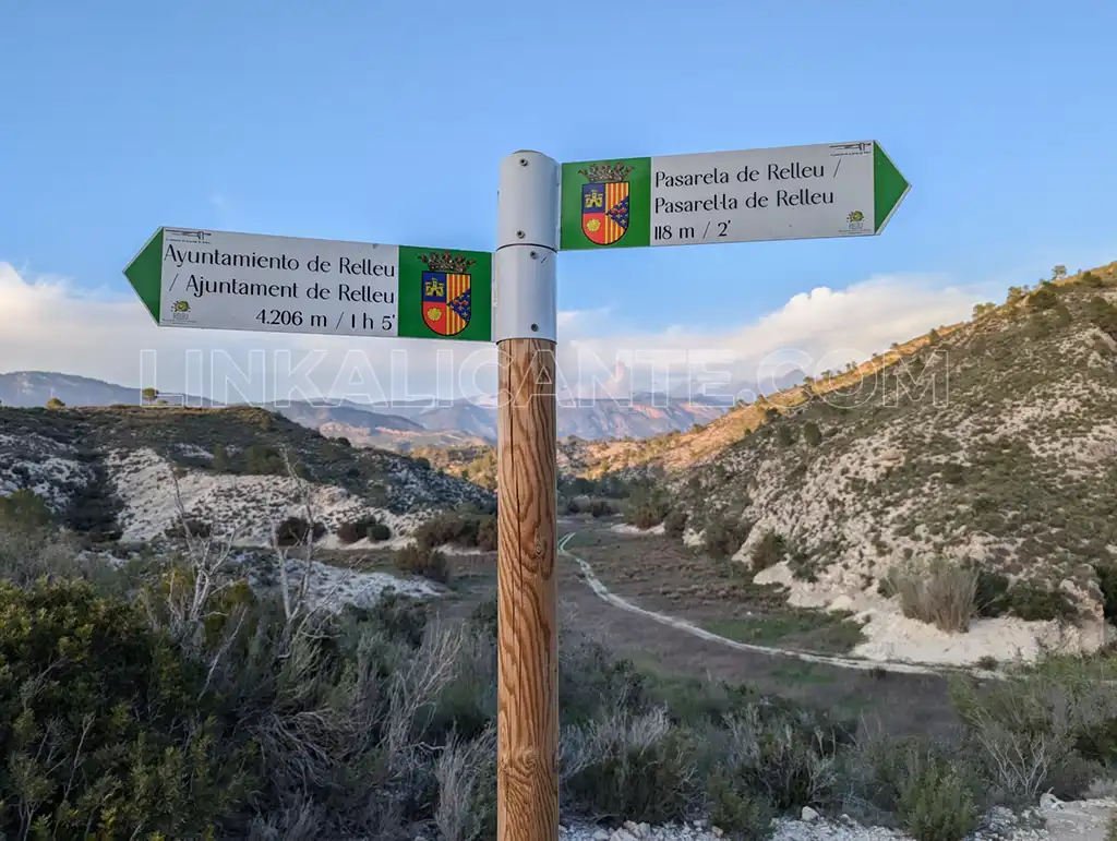
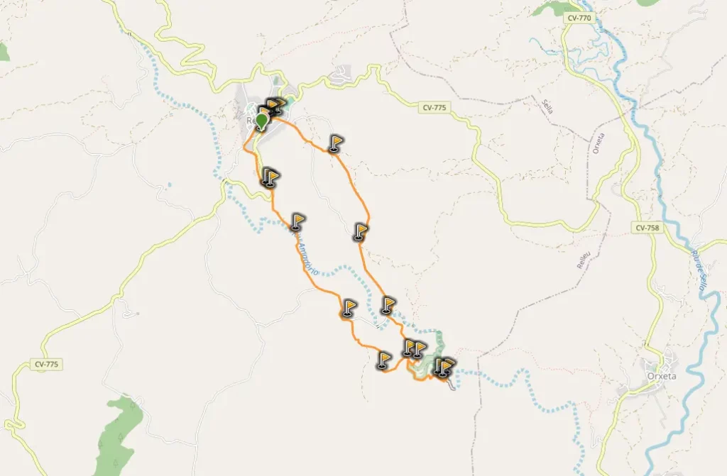
The hiking route to reach the footbridge from Relleu has a total length of 9.2 kilometers and begins next to the town’s Town Hall. Halfway along the route you will reach the floating wooden footbridge. Tickets must be purchased in advance to visit the walkway.
This simple route runs along agricultural paths between terraces of almond trees , a traditional crop in the area that, due to the Xylella fastidiosa bacterium, has seen its extension in the province of Alicante decrease.
It is a circular route , which we recommend to follow in counterclockwise direction, although it can be done in both directions.
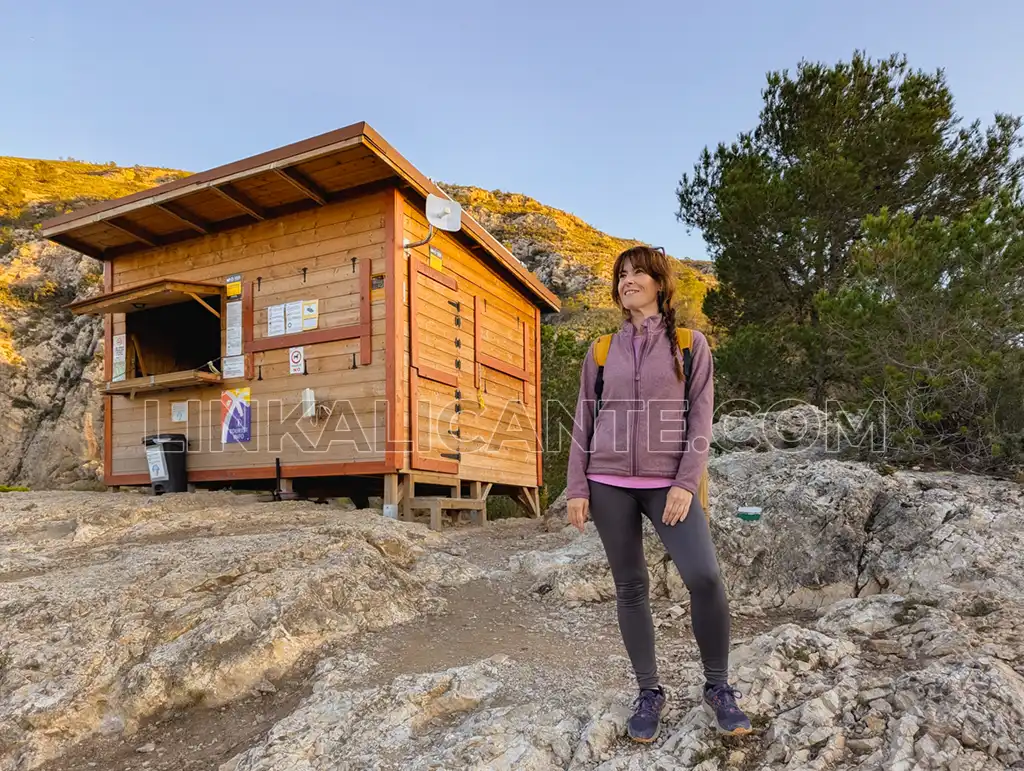
Leaving the Town Hall and after about 3 kilometers we reach the bed of the Barranc de la Cova, one of the streams that tributary waters to the reservoir. Bordering what would be the water sheet of the reservoir (which is normally dry), we reach the Casa del Guarda and shortly after the vertical of the dam, the point where the dizzying wooden walkway of 370 meters long and 50 meters high begins: “El Caminito de Relleu”.
The walkway itself, although vertiginous, does not entail any difficulty and it is not necessary to equip yourself with safety material (it is not a via ferrata). The most vertical part is the final middle section, ending in a glass-floored observation deck.
Once we have visited the reservoir and the walkway, we return along the same path to the indicator that takes us to the other part of the circular route, back to Relleu on a slight climb. This part of the route has more asphalt, as it becomes part of it through the road that connects the town with the reservoir.
Short Route to the Relleu footbridge
There is the option to go by car to the vicinity of the footbridge and park the vehicle on a rural road, always without disturbing or obstructing the passage of emergency vehicles. From there, the walk to the footbridge is 3 km round trip.
@linkalicante Ampliación de la Pasarela de Relleu, ahora más desafiante 😨😨 #pasareladerelleu #relleu #costablanca #comunitatvalenciana #rutasalicante #senderismoalicante #provinciadealicante @Turismo Costa Blanca ♬ Can You Hear The Music - Ludwig Göransson
Relleu footbridge extensions
In December 2023 the first extension of the Relleu footbridge was inaugurated. This had a budget of 60,000 euros and extended the existing section by 150 meters . The novelty in this new section was the section of descent to the bottom of the ravine through several segments with stairs, entering the narrowest and deepest part of the ravine, known as l’Estret del Pantà (the narrow part of the swamp).
Expansion 2024
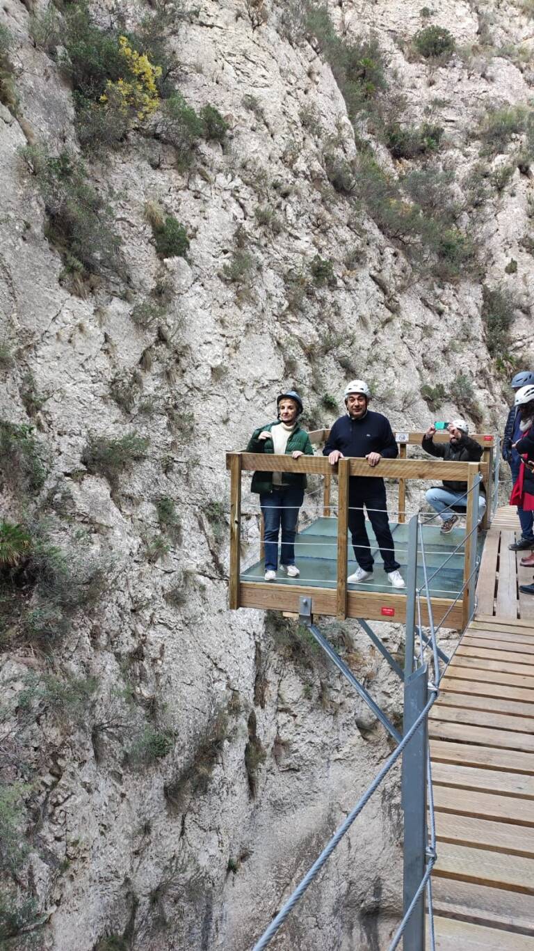
In December 2024, the second extension was carried out, with a budget of 50,000 euros. It is just 20 meters extra, but with the great attraction of a second glass-floored observation deck.
In addition, this point will be key in view of the future expansion, scheduled for 2025, which will make the route circular, through a bridge that will allow crossing to the opposite side of the ravine, to make the return trip along that side.
ROUTE SHEET
- Difficulty: Easy
- Circle Route
- Distance: 9.2km
- Slope: 200 m.
- Estimated time: 4 hours
- Attention: children must always be supervised by an adult.
Rules of Use “Caminito de Relleu”
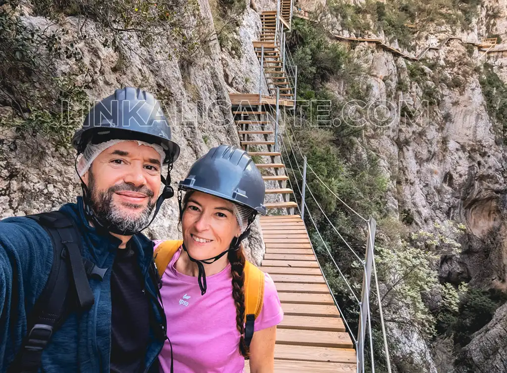
It is important to comply with safety regulations and make responsible use of the dam walkway.
Safety regulations establish a maximum of 4 people per section . Children must always be supervised by an adult.
Below you can consult the official information on the Relleu Tourism website:
Relleu Reservoir: Environmental Values
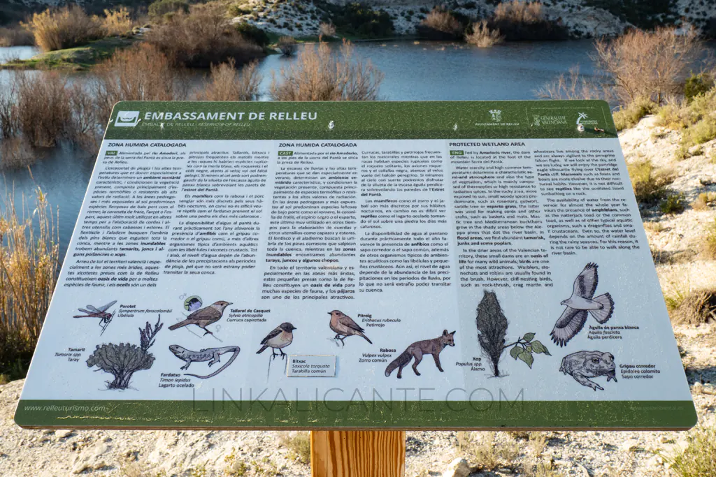
Species as sensitive as the Bonelli’s eagle nest on the vertical walls of the strait that you are going to visit. That is why we ask you to access this space quietly, without shouting and slowly , so as not to disturb the native fauna.
The Relleu reservoir is a listed wetland that serves as a refuge and food source for many species of birds, amphibians and reptiles , as well as mammals such as foxes and wild boars.
History of the Relleu Dam
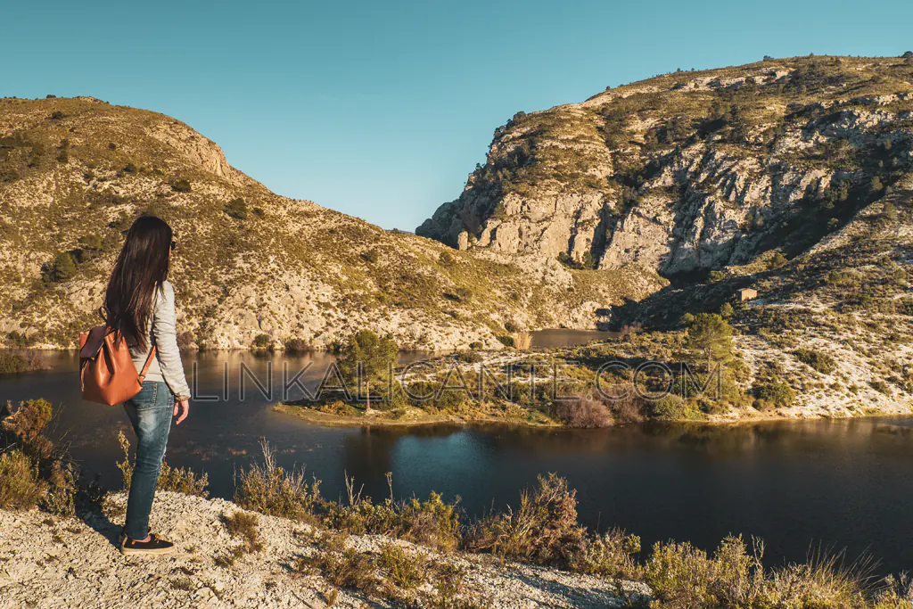
Like other dams in the province of Alicante, such as the Tibi or Elche reservoirs, the Relleu Reservoir dam is among the oldest in Europe. It is estimated that its construction was completed at the end of the 17th century, coming into operation at the beginning of the s. XVIII. Its construction was an initiative of the inhabitants of La Vila Joiosa , given the scarcity of water for their crops.
Designed by the Renaissance engineer Cristóbal Antonelli , the Relleu reservoir dam is 32 meters high (it was originally 28 meters) and 30 meters long. It is considered one of the narrowest and tallest of its time, thanks to the application of innovative techniques with an arch-vault-shaped construction that transfers the thrust of the water to the walls of the ravine.
Currently, the reservoir bed is partially clogged with sediment and remains dry most of the time, except in times of heavy rains.
More Plans in Relleu
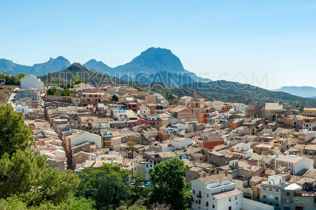
If you want to know other attractions of Relleu, both natural and cultural, I invite you to see the article we dedicated to this beautiful town in the interior of the Marina Baixa:
How to get there and Parking
On the official website of Turismo Relleu you can check the free car parks available in the town, from where the hiking route begins to visit the dam and the walkway.
Route Track for GPS
Although the route is very easy to follow, below you can view / download the track of the route for GPS via wikiloc.

