Route of the Forat de Bèrnia, natural tunnel and viewpoint overlooking the Mediterranean Sea

El Forat de Bèrnia, vistas a Altea

The Forat is a natural tunnel about 15 to 20 meters long that crosses the Sierra de Bèrnia from north to south. At its widest mouth, overlooking Altea, the Serra Gelada and the Mediterranean, El Forat de Bèrnia is very wide, a great natural shelter that serves as a magnificent viewpoint of the Costa Blanca.

Would you like to take the hiking route that will take you to this magical place? Read on, I’ll tell you all the details below…

Alerta
Do you know the 10 Essential Routes in Alicante?
The excursions that any mountain lover should do at least once in a lifetime.

Route to the Forat de Bèrnia

ruta-forat-bernia-trepadas
Zona de trepadas antes de El Forat

We start from Casas de Bèrnia, where we find the information panel of the PR-CV 7 trail, which is the one we are going to follow. At the beginning we have to head towards the Font de Bèrnia -to the left looking towards the mountain range-.

Up to the fountain, we follow a wide and practically flat path. From the fountain, we start the ascent by path to El Forat, overcoming an unevenness of about 300 meters and some rocky areas where we will have to help us with our hands, as the terrain is steep.

It is not an excessively difficult route but it does present terrain with some difficulty and requires adequate material and a certain habit of walking in the mountains.

Data sheet

RECOMMENDATION: it is well worth doing the complete Bèrnia circular, to pass by the Renaissance fort and enjoy the varied landscapes offered by the mountain range. It is a bit longer and more demanding.

Additional Information

Cases de Bèrnia route of the Forat
Cases de Bèrnia, starting point of the route

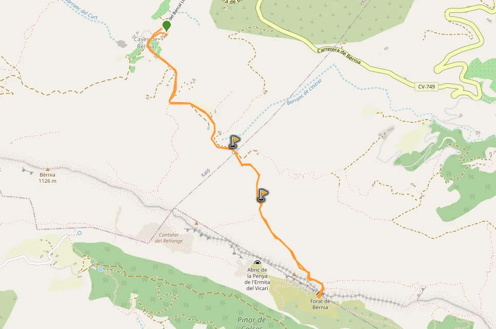
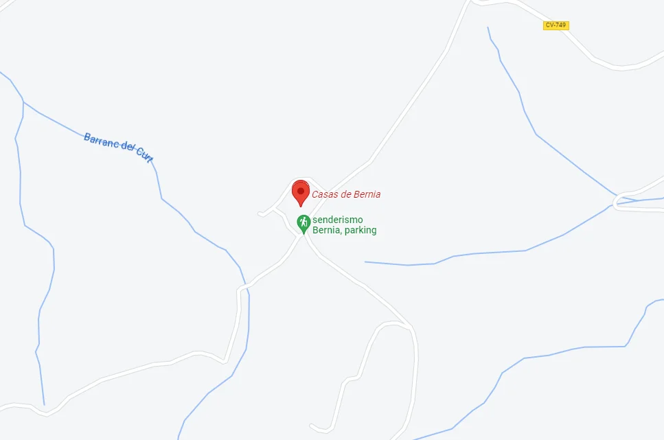
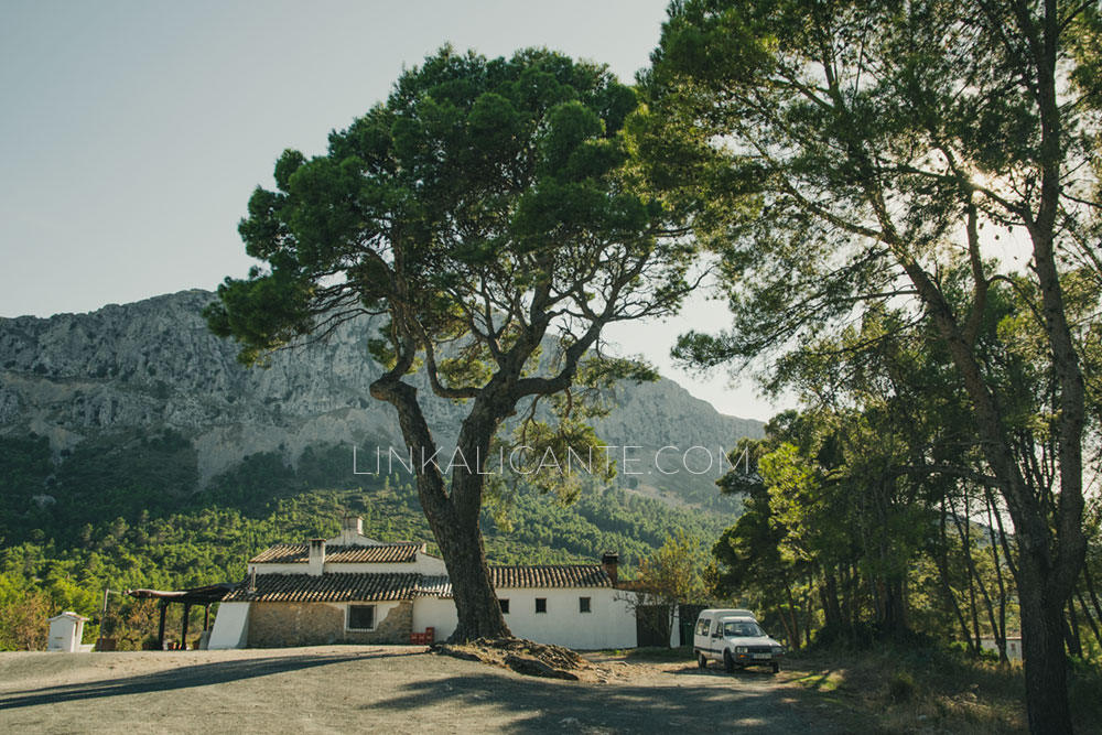
The simplest and shortest route to reach the Forat de Bèrnia begins in Casas de Bèrnia, a tiny hamlet belonging to the town of Xaló / Jalón.

This route is very popular, so my advice is to avoid weekends and holidays, as on those days there are usually many people doing this route and you may have to “save time” to be able to pass El Forat. In addition to not enjoying it as much, it can be harmful to the environment.

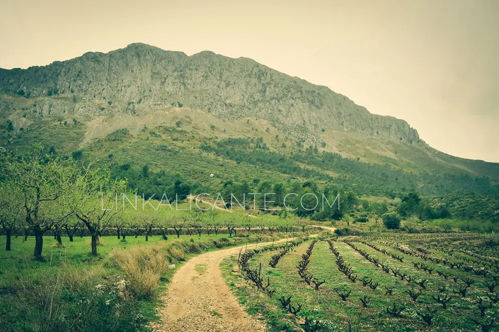
The Sierra de Bèrnia, together with the Sierra del Ferrer, give rise to a Protected Landscape (similar to a Natural Park) declared by the Generalitat Valenciana for its high environmental and heritage values.

North face of the Bèrnia mountain range

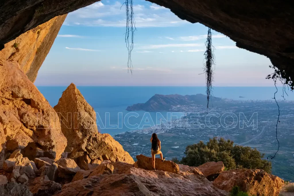
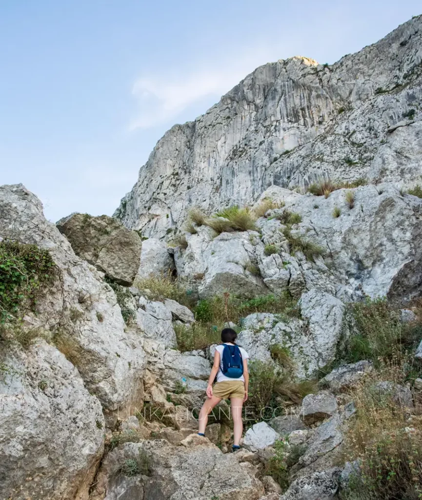
As a curiosity, we started the route on the north side of the mountain range, much greener and wetter, and after crossing the Forat we went to the south side, drier and with views of Altea, Benidorm and Puig Campana. In both cases the route is very spectacular as we walk at the foot of the great limestone ridge that crowns the Sierra de Bèrnia.

Another curiosity is that the route begins in the municipality of Xaló and then crosses over to the municipality of Benissa and finally to the municipality of Altea when crossing El Forat. The Fort of Bèrnia, on the other hand, is located in the municipality of Callosa d’En Sarrià.

Narrow part of Forat de Bèrnia

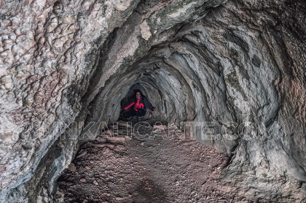
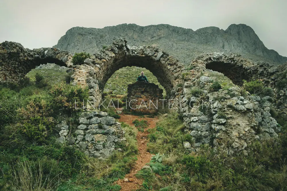
As for the Forat, it is located about 800 meters above sea level and has a length of about 15 meters. Years ago it was somewhat more difficult to cross, but the incessant passage of hikers has made the narrow opening, which faces the north face, has been widening slightly by erosion, especially on rainy days.

At the beginning you will have to pass in blades and little by little you will see how it widens until it ends in a large cave or natural shelter overlooking Altea.

Circular Variant

Fuerte de Bèrnia - Fort de Bèrnia

If you want to visit the Forat de Bèrnia, I strongly recommend you to do the complete circular. The route is only slightly more difficult and somewhat longer. This way you will be able to know the Fort of Bèrnia and other attractions and panoramic views of one of the most beautiful and emblematic mountain ranges of the province of Alicante.

Track for GPS

I share with you the track of the complete circular route, which you can follow to make the route to and from the Forat or the whole excursion.

How to get

You can reach Casas de Bèrnia:

  • From Benissa, passing through Pinos. More scenic road but with more curves.
  • From Xaló. Slightly shorter road.

In both cases, keep in mind that these are narrow rural roads with bicycle traffic. If you go in a group, try to go up with only one car as parking space is limited and it is a very busy route on holidays and weekends.

Click on the image to open in Google Maps:

Keep exploring...
Rate this item
1 estrella2 estrellas3 estrellas4 estrellas5 estrellas (Sin valorar todavía)

Subscribe by e-mail

Join our email newsletter and we will inform you of new routes and plans in nature in Alicante and Comunitat Valenciana.

Good practices
Find out, Plan and Equip yourself well to enjoy to the fullest.
Respect the Cultural Heritage (ruins, stone margins, etc).
Respect other people and private property.
Respect flora, fauna and environment. Enjoy in Silence.
Always follow the trails. Tackling damages the environment.
Do not leave a trace of your passage, nor organic remains.
Thanks!

Leave a Comment

Your email address will not be published. Required fields are marked *

This site uses Akismet to reduce spam. Learn how your comment data is processed.

Scroll to Top