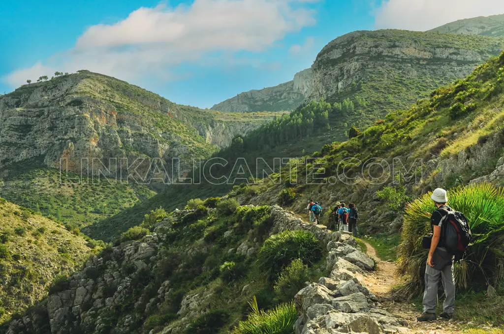
This is one of the essential hiking trails in Alicante: in the magical Vall de Laguar, surrounded by mountains, hides El Barranc de l’Infern, a spectacular and deep ravine that the waters of the river Girona have sculpted over thousands of years.
This amazing ravine is the protagonist of one of the most unique hiking trails in Alicante: the PR-CV 147 marked trail, known as “La Catedral del Senderismo” (The Cathedral of Hiking).
This is a circular route of great beauty that, through fascinating landscapes, will take you to discover an outstanding cultural heritage, set in a natural setting of great ecological value.
To overcome this demanding excursion, you will have to climb up and down a staggering 6,800 stone steps. Stay to the end and take note to find out all you need to know… Let’s go!
Índice del Artículo
ToggleBarranc de l’Infern: Route summary
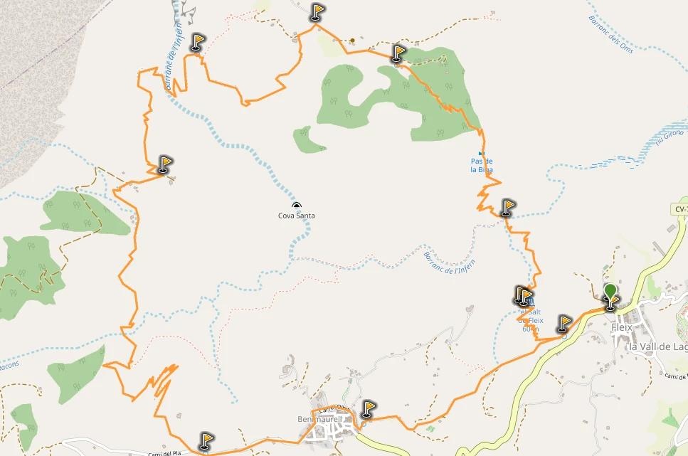
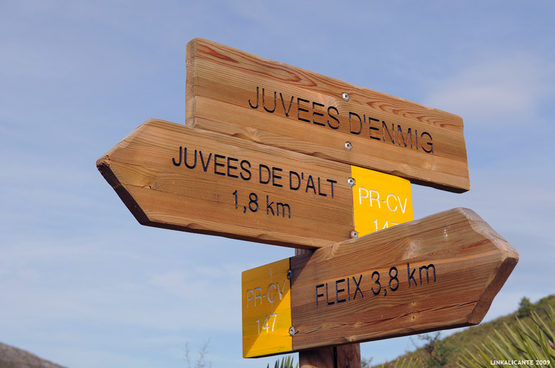
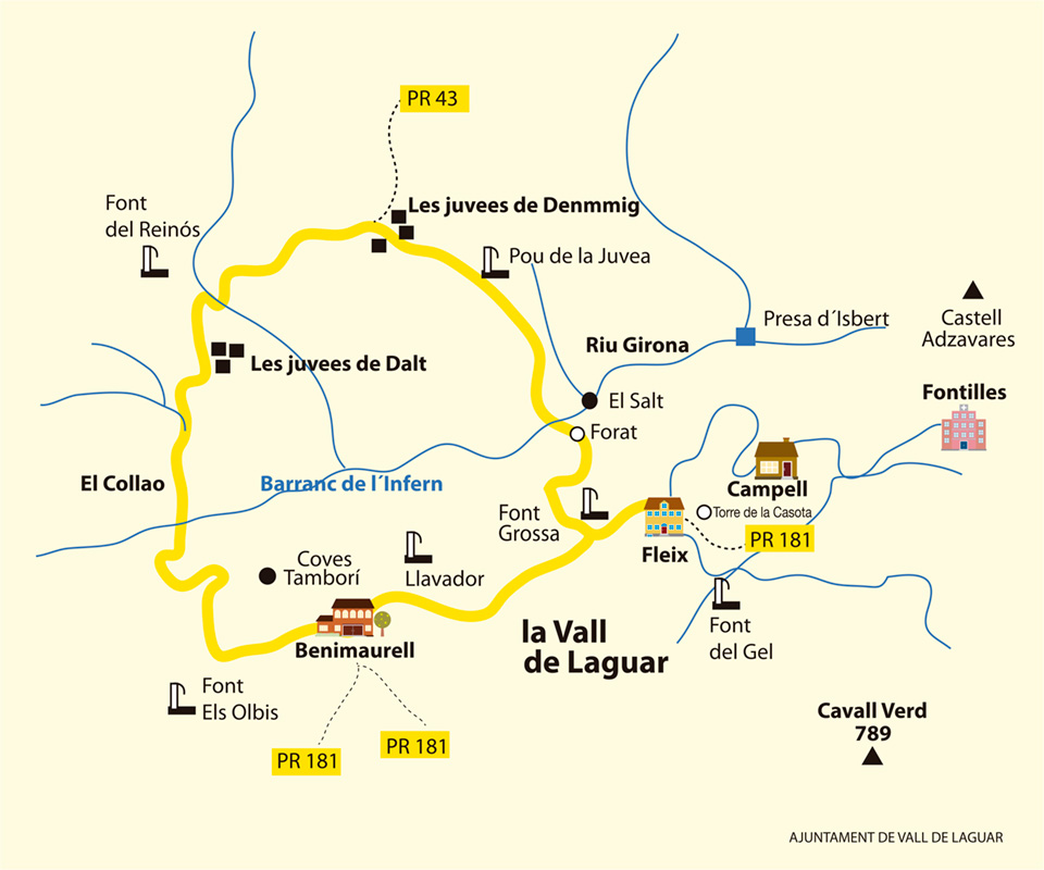
This circular hiking route runs around the Barranc de l’Infern (Barranc del Infierno in Spanish). The excursion is known as “The Cathedral of Hiking” or “The Route of the 6,800 stone steps”, although the original name of the trail is “Camí de les Juvees”.
It is a physically demanding but technically simple route. You don’t need to overcome rappels or anything like that, just be in good shape to face the ascents and descents.
We start from the town of Fleix, one of the three that make up the municipality of La Vall de Laguar, in the Alicante region of the Marina Alta. From there, and always following the marks of the PR-CV 147 trail, the route will take us, through zigzagging and continuous ascents and descents, to cross the spectacular Barranc de l’Infern twice.
After overcoming the second “descent to hell”, a demanding final ascent will finally take us to Benimaurell , the town above. Now we only have a comfortable descent back to Fleix, ending this beautiful hiking route.
Article originally published in November 2009 in LinkAlicante. Last updated: March 2025.
Data sheet
- Physical Difficulty: Medium-High
- Technical difficulty: Easy
- Circle Route
- Distance: 14km
- Slope: +800 meters
- Approximate time: 5-7 hours
- Signaling: PR-CV 147
Photo Gallery
Accommodations in La Vall de Laguar
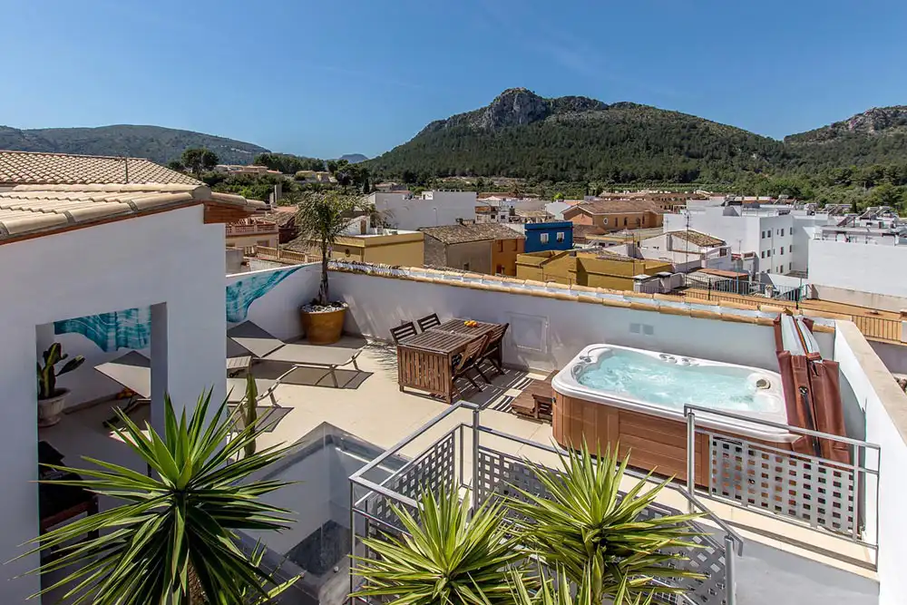
La Vall de Laguar is a fantastic place for a weekend getaway to soak up its history, its landscapes, and its rich gastronomy. For this reason, I take the liberty of recommending some nearby accommodation:
✔️ Mardenit, adults only hotel in Orba (8 km from Fleix). Pets are welcome.
✔️ Casa Rural Ca Lluis, in Campell, “the village below” in La Vall de Laguar.
✔️ Cassa Lennisa, beautiful villa located at the foot of Cavall Verd, between Murla and Fleix.
Barranc de l’Infern, World Heritage Site
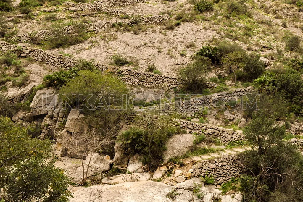
Beyond its impressive landscapes, this hiking route around the Barranco del Infierno hides a cultural heritage of great value that is in danger of disappearing. I’m talking about the construction technique of dry stone, declared Intangible Cultural Heritage of Humanity by UNESCO in 2018.
The terraced mountains with dry stone margins are part of the identity of the Marina Alta region. Here the landscapes tell us about the use of nature by human beings for centuries. Dry stone – that is, building without any mortar – played a fundamental role in these lands, both in crop margins and in paths, wells, shelters, etc.
This is one of the best examples of the invaluable dry stone heritage in the province of Alicante. A legacy that must be preserved. In many parts of this route, if you look closely, you will see how the path is supported by a structure created with this technique. Possibly it is from the Moorish period or older… Can you imagine how many times it has been traveled by farmers and mules over the centuries? I encourage you to keep this in mind during your hike.
Description of the Route and Photographs
Click to Read Description
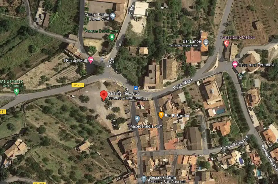
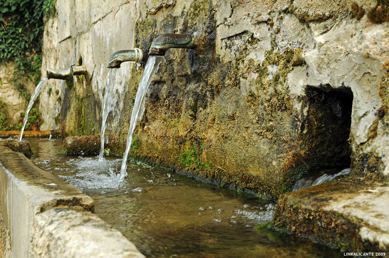
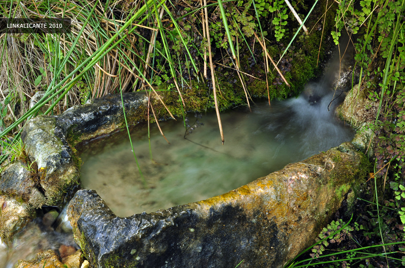
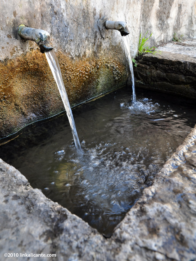
We start the tour in Fleix, the “poble d’enmig” of the three that make up the Vall de Laguar. We leave the car at the entrance of the village, in a parking lot next to the CV-721. Just 30 meters up the road we see the signs that, by asphalt country road, lead us to the Font Grossa and old village laundry.
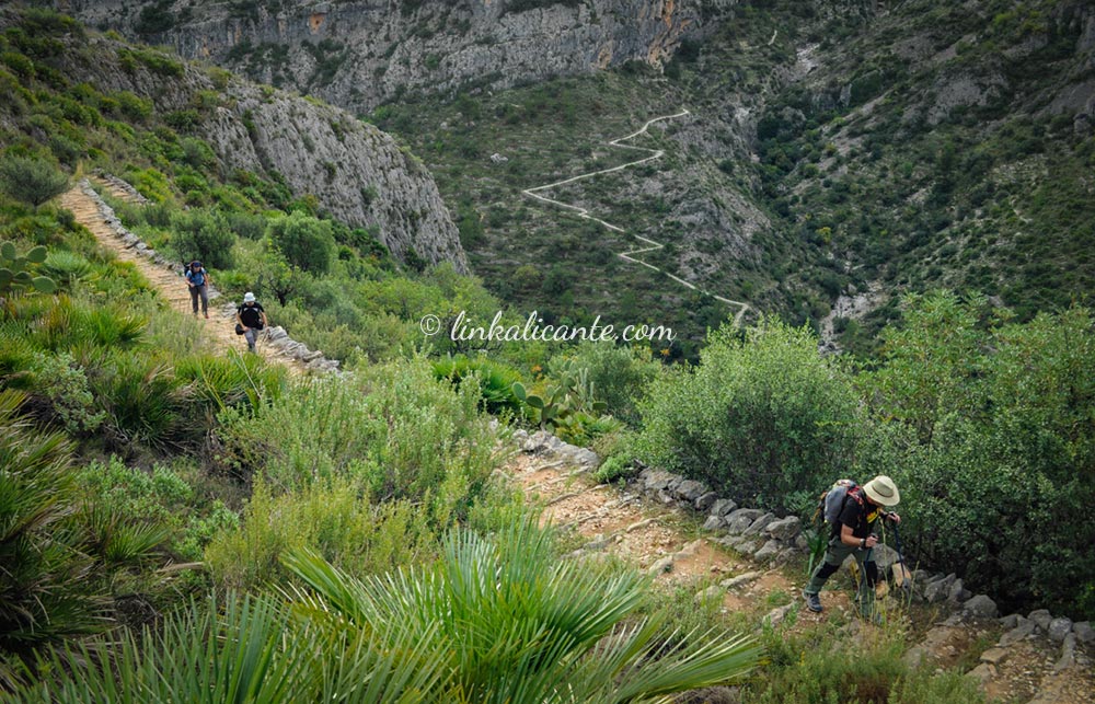
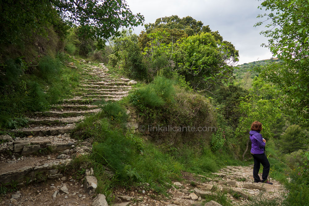
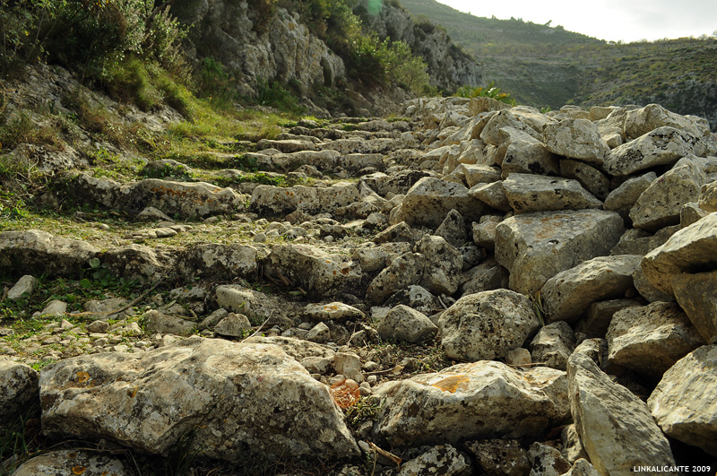
After passing this picturesque piece of history, we immediately see the path that turns off to our right, with the indicators of the PR-CV 147. The stone “steps” begin, of which there are said to be more than 6,800. Just this once, we’re going to believe it and not keep score.
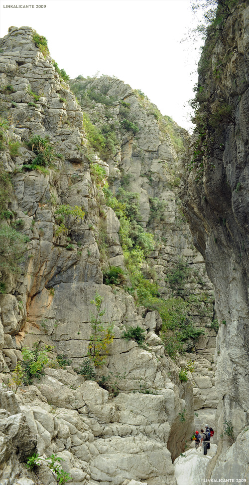
It does not take long to appear before us the impressive descent to the dry riverbed of the Girona River and the no less spectacular climb up the opposite side of the ravine.
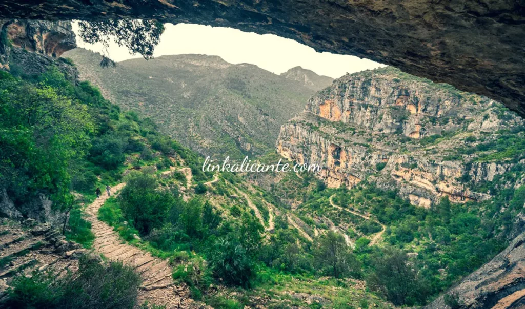
But let’s not anticipate events. Before that, we will have to pass by the head of the Barranc del Salt , several tens of meters high. We then cross El Forat de la Juvea, a hole carved in the rock that allows us to continue advancing while enjoying a memorable panoramic view (the photo at the top of this article).
This first part of the PR-CV 147 trail hides a natural wonder that often goes unnoticed. After episodes of torrential rains, the Barranc del Salt (or Barranc de Fleix) gives rise to an impressive waterfall of 65 meters in total height. Next, you can see this natural spectacle in the video I have prepared…
We continue descending and finally arrive at the bed of the Riu Girona , which usually remains dry. Down the ravine, it is possible to visit the Isbert dam , although from this side it is less attractive.
It is time to take a break and regroup, before starting the steepest climb of the day, in which we will have to overcome a drop of about 300 meters positive, again with a staggered path. It is known as“Camí de la Juvea“, an old access road to farmland.
Beyond the effort, the road has no difficulty whatsoever, and it is worth taking it easy and enjoying this fantastic scenery. It is not hard to imagine the old Moorish settlers, living and cultivating these lands, until their definitive expulsion in 1609.
The zigzagging ascent leads us to Les Juvees d’Enmig, where we take another break and discuss the anecdotes of the day. We pump water from the Pou de la Juvea to refresh ourselves.
When resuming the march, a small ascent takes us to an esplanade next to some houses. Then we take the path to the left, which will make us “go down to hell” again.
This second descent, which goes through places that seem to have escaped from a dream, leads us to the Font de Reinós, where we will have lunch.
When we resume the march, we finish the downhill section that leads us to the bed of the Barranc de l’Infern. From this point, it is possible to approach the beginning of the sport canyon, a section that can only be overcome with the help of advanced canyoning materials and techniques. The spectacle is overwhelming . Vertical walls that seem to ascend to the sky, populated by lush vegetation.
We retrace our steps to retake the path PR-CV 147, a few meters above the point where we crossed the ravine. Be careful not to get lost at this point, always look for the trail markers.
We now face the second of the climbs, also demanding, which will lead us to the old hamlet of Les Juvees de d’Alt. Again, I recommend taking it easy and enjoying each of the thousands of stone steps that make up this magnificent route.
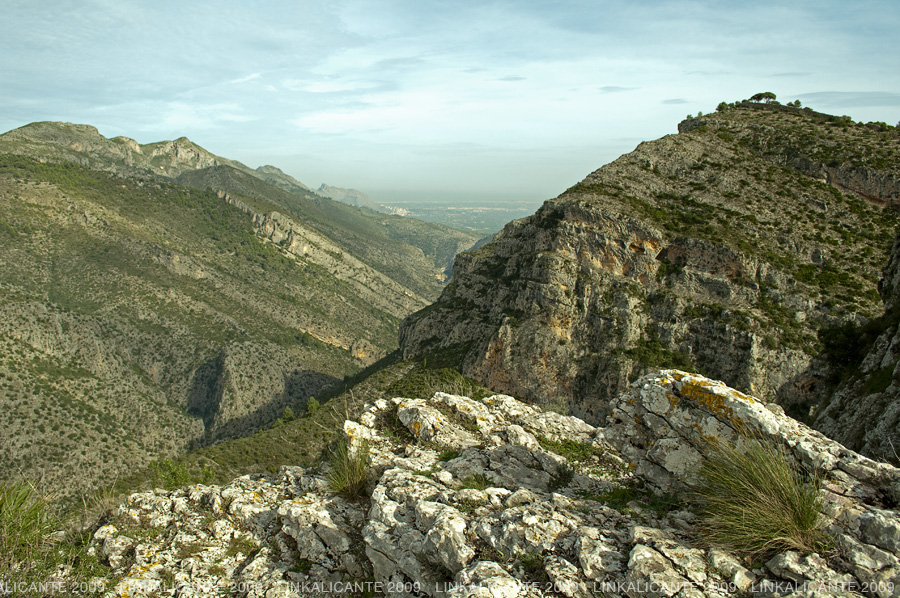
At the top, we have spectacular panoramic views of the Barranc de l’Infern, at the foot of the Sierra de la Carrasca (on the left).
We are in Les Juvees de d’Alt, an uninhabited hamlet, where we find several buildings in ruins and a couple of cisterns. From here, we begin a new descent towards the so-called Barranc de Racons, a tributary of the . At this point of the route, the stone steps or “rastells” seem to be better preserved.
Soon we reached the bottom of the Barranc de Racons and began the last, winding and staggered climb. Halfway up, we reach a natural viewpoint where we must stop and take a deep breath, the scenery is breathtaking.
We resume the march and, after one last steep climb, we finally finish our ascent from “hell”. We arrive at a beautiful area of terraced fields on the outskirts of Benimaurell, “the village above”.
The path leads us to the asphalt road that, if we follow it to the right, will take us to La Venta del Collao, a restaurant with an exceptional location.
To finish the circular route of the Barranc de l’Infern, we follow the asphalt to the left, gently descending, and soon we reach the recreational area of the Font dels Olbis.
Shortly after, we cross the village and arrive at the Font de Benimaurell, next to the village washing place.
This may be a good place for a last rest and/or to replenish water. From here to Fleix we only have a gentle walk following the paved path between terraces.
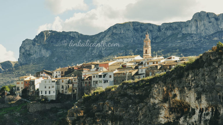
While we enjoy the last steps, between the trees appears the silhouette of the Serra del Cavall Verd or Serra del Penyó, on which the three villages of the Vall de Laguar are located: Campell, Fleix and Benimaurell.
Tired but very happy, we go through the last steps while we comment on the anecdotes of the day. We complete the route, we close this “magic circle” of the Vall de Laguar. As I said at the beginning, an essential excursion in Alicante , for all lovers of nature, history and the culture of our land…
Track for GPS
Although the short distance trail PR-CV 147 is perfectly signposted, I leave here the gps track in wikiloc, in case you want to download it and take it as a support.
How to get there / Parking
Finally, I leave you the location of the recommended parking next to the start of the route in Fleix. Keep in mind that this is a fairly popular route and on weekends it is possible for the parking lot to fill up. You will be able to park in the surrounding area, always respecting private property. Thank you for taking care of the environment!
Click to view on Google Maps:
Tips for the Route
Although in this case we are not climbing a mountain, keep in mind that it is a demanding route from a physical point of view, especially if you are not used to walking in the mountains.
What is the best time to do the Barranc de l’Infern route?
Any but summer, as it is too hot. In spring the area looks especially green and beautiful. In February and March, respectively, you will find almond and cherry trees in bloom.
Is the PR-CV 147 trail signposted?
Yes, it is signposted with white and yellow markings (small trail), signposts and information panels. If you go on a weekend you will find quite a few people hiking the trail. For all these reasons, it is easy to find your way along the route. For added safety, you can carry a GPS or track on your smartphone.
Is there any danger on the PR-CV 147 route?
After episodes of torrential rains the Barranco del Infierno and its tributaries can descend with a lot of water, making it impossible to practice the route (and very dangerous to try).
Are there fountains on the route of the 6,800 steps?
There are fountains in Fleix and Benimaurell, as well as the Font de Reinós next to the ravine. Note that the water is not treated (chlorinated), so drinking it may not be 100% safe.
What equipment is suitable for the PR-CV 147 trail?
The usual equipment for hiking. Remember to bring plenty of water, food to replenish your strength and sun protection.
Do not miss...
The Route of the 8 Villages of the Vall de Gallinera
The Route of the 8 Towns is a linear route through agricultural paths of the Vall de Gallinera, connecting the 8 picturesque towns of this beautiful valley of the Marina Alta.
Links of interest
- Vall de Laguar Town Hall
- The PR CV-181 , another path in the Vall de Laguar
- The Cavall Verd massacre , article in El País
- 400 years since the expulsion of the Moors