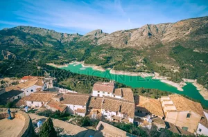
10 Places to see in Guadalest, the most beautiful village in Alicante?
Discover the best 10 places to see in Guadalest, the beautiful medieval village of Alicante surrounded by mountains and with amazing museums.

✓ Artículo en El Mundo sobre Fernando Prieto y el calendario fotográfico de LinkAlicante edición 2018.
✓ Entrevista a Fernando Prieto para la revista Generación Fénix.
✓ Artículo en Última Hora sobre la fotografía de Mallorca desde Alicante realizada por Fernando Prieto.
✓ Intervención de Fernando Prieto en el programa “Nómadas” de RNE.

Discover the best 10 places to see in Guadalest, the beautiful medieval village of Alicante surrounded by mountains and with amazing museums.

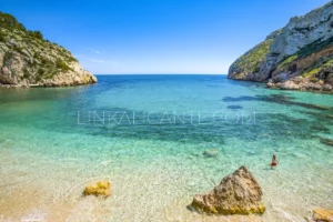
Discover the 10 Best Coves of Alicante and its location map in this tour from north to south along the coast of the Costa Blanca.
To provide the best experiences, we and our partners use technologies like cookies to store and/or access device information. Consenting to these technologies will allow us and our partners to process personal data such as browsing behavior or unique IDs on this site and show (non-) personalized ads. Not consenting or withdrawing consent, may adversely affect certain features and functions.
Click below to consent to the above or make granular choices. Your choices will be applied to this site only. You can change your settings at any time, including withdrawing your consent, by using the toggles on the Cookie Policy, or by clicking on the manage consent button at the bottom of the screen.